New Delhi: India has officially standardised the names of 27 prominent geographical and strategic locations in Arunachal Pradesh on Survey of India maps, marking a significant step toward strengthening geographical and administrative clarity along the country’s northeastern frontier.
The exercise was carried out in consultation with the Arunachal Pradesh government and covers a wide range of locations, including mountain passes, lakes, settlements, historic areas and sites associated with India’s military heritage.
Arunachal Pradesh shares international borders with China, Bhutan and Myanmar, making accurate mapping and official recognition of locations particularly important for administration, infrastructure planning and border management.
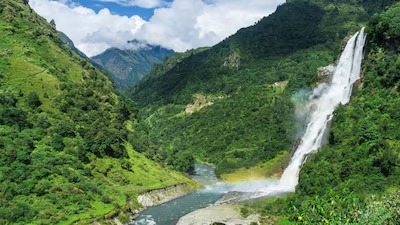
The newly standardised names include several high altitude mountain passes such as Dzo La, Riza La, Pukur La and Thag La. Sambho Sarovar, an important high altitude lake, has also been incorporated into the official mapping framework.
Several settlements and historically significant areas have received formal recognition as well. These include Longju, Maja, Bisa, Jairampur, Sunpura and Kamlang Nagar. Cultural and spiritual landmarks such as Buddhamandir and Pritnagar are also part of the updated geographical record.
The move comes amid recurring disputes over attempts by China to assign alternative names to locations in Arunachal Pradesh. India has consistently rejected such naming exercises and maintained that Arunachal Pradesh is an integral part of the country.
The updated maps also highlight locations associated with India’s military history. Jaswant Garh, named after Rifleman Jaswant Singh Rawat, who was awarded the Maha Vir Chakra for his role during the 1962 India China conflict, features among the recognised sites.
The Sher-e-Thapa Memorial and other historically important defence positions, including Baisakhi, have also been incorporated into the national mapping framework.
By formally standardising these names, the government aims to create greater consistency across official records, educational material, administrative documents and geospatial data. The updated mapping system is expected to support more precise governance and planning across Arunachal Pradesh’s strategically important border areas.
Sorry, there was a YouTube error.