Team Goemkarponn
PANAJI: The Goa State Election Commission has formally notified the delimitation of wards for the ensuing general elections to 11 Municipal Councils, setting out detailed boundaries and areas that will determine the electoral map for the forthcoming civic polls.
The notification, issued on September 9, 2026, by State Election Commissioner Menino D’Souza, IAS (Retd.), has been published in the Extraordinary issue of the Official Gazette. It has been issued under sub-section (3) of Section 10 of the Goa Municipalities Act, 1968.
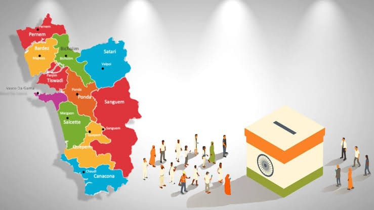
The exercise covers Mormugao, Margao, Mapusa, Curchorem-Cacora, Bicholim, Cuncolim, Quepem, Canacona, Valpoi, Pernem and Sanguem Municipal Councils.
The notification provides extensive descriptions of the geographical limits of each ward, identifying specific roads, junctions, landmarks, residential colonies, government establishments, religious structures, commercial areas and other identifiable locations.
It also links the wards to the relevant Assembly constituencies and specifies the corresponding parts, sections and house numbers falling within each ward. The detailed descriptions are intended to establish the precise territorial limits of every ward covered by the delimitation exercise.
In Mormugao, for instance, the delimitation covers areas around Sada, Headland and Mormugao Harbour, with individual wards described using prominent landmarks and residential areas. The notification also identifies several MPA/MPT-related residential quarters and other localities falling within the respective wards.
The Mormugao ward descriptions further include areas such as Customs Colony, Headland Sada, Government High School areas and Sada Sports Complex, among other localities and properties.
Margao Municipal Council has also been provided with detailed ward boundaries, with localities identified through landmarks, roads and house numbers. The delimitation covers areas including Mungul, Fatorda, Aquem and Pajifond, among other parts of the municipal jurisdiction.
In Mapusa, the ward descriptions include areas such as Cunchelim, Duler, Dangui Colony, Angod and Rajwado, along with corresponding house numbers and other identifying details.
The level of detail in the notification means that the boundaries of several wards are identified down to individual properties, residential units and housing colonies. This provides a precise basis for determining the areas that will form part of each municipal ward.
The delimitation exercise also covers Curchorem-Cacora, Bicholim, Cuncolim, Quepem and Canacona Municipal Councils.
For Canacona, the notification identifies wards through areas including Char Rasta, Nagarcem and Palolem, with the respective wards linked to specified parts of the Canacona Assembly constituency.
Palolem, in particular, has been mapped through detailed property and house-number descriptions, with the notification specifying the houses falling within the ward limits.
Bicholim’s ward boundaries are similarly set out through specific localities and property details, while the Cuncolim delimitation includes areas such as Panzarconi and Comba.
The notification further covers Valpoi, Pernem and Sanguem Municipal Councils.
In Valpoi, Ward I covers areas around the GPS at Velus and is linked to the relevant portion of the Valpoi Assembly constituency.
In Pernem, the notified boundaries include areas such as Bedgewada and localities around the Kaloba Temple, GPS Paraste and Ganpati Temple at Bagayatwada.
For Sanguem, Ward I covers specified parts of the Sanguem Assembly constituency, including areas around Bamonsai, with detailed house numbers forming part of the ward description.
The publication of the delimitation marks an important administrative stage in the process leading to the general elections to the 11 Municipal Councils. By formally defining the territorial limits of the wards, the State Election Commission has established the electoral framework within which the civic elections will be conducted.
The detailed notification is likely to be examined closely by political parties, prospective candidates, municipal representatives and voters, particularly in areas where changes or clearly defined ward boundaries could influence local electoral strategies.