New Delhi: India has raised concerns over anomalies in a recently issued United Nations world map that depicts Arunachal Pradesh and Aksai Chin separately from the country. New Delhi clarified that its support for a UN General Assembly resolution promoting more accurate and equitable maps should not be interpreted as acceptance of the disputed depiction.
India had voted in favour of the African Union backed resolution, which promotes the use of equal area map projections to ensure that the relative size of continents and regions is represented more accurately. However, India stressed that the resolution does not endorse any particular map.
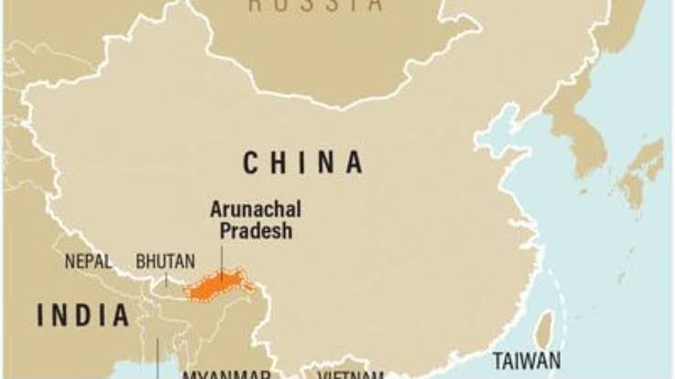
The map, published by the UN on July 1, has drawn attention for its depiction of Arunachal Pradesh as a separate region between Assam and China. It also does not show Arunachal Pradesh sharing a border with Nagaland.
Aksai Chin has similarly been represented as a separate region, with India shown to its west and China to its east. The UN has not provided a specific explanation for these changes.
The map also includes a dotted line representing the Line of Control in Jammu and Kashmir. A footnote states that the line broadly reflects the LoC agreed upon by India and Pakistan, while noting that the final status of Jammu and Kashmir remains unresolved between the two countries.
India has consistently maintained that Jammu and Kashmir and Ladakh, including Aksai Chin, are integral parts of the country. New Delhi has also repeatedly affirmed that Arunachal Pradesh is an integral part of India.
The UN resolution, adopted on September 4, seeks to encourage more equitable cartographic representation, particularly for Africa. It addresses concerns over the distortions associated with the Mercator projection, which can make areas closer to the poles appear significantly larger than their actual size.
The Equal Earth projection, introduced in 2018, instead focuses on preserving the relative areas of continents, offering a more proportionate representation of the world.